So we’ve missed a ton of time updating the blog and I’m going to have to dive right back in to the present to get restarted. I have some half-written blogs from the last 6 months that I will eventually get uploaded, but here’s the not-so-quick recap.
After the last post – arriving in Maine in July – we went to Iceland. It was amazing and will someday get its own full post. There are far too many amazing places and pictures to cover here.
Seljalandsfoss. Playing behind Seljalandsfoss. Hiking above Þórsmörk.
On the way from Maine back to Oregon we did some mountain biking in Copper Harbor, Michigan.
Looking good. Perhaps I should have stopped at this nice little jump. Add Hancock, MI to the list of emergency rooms I’ve visited. Grade 2/3 AC Separation. Ugh.
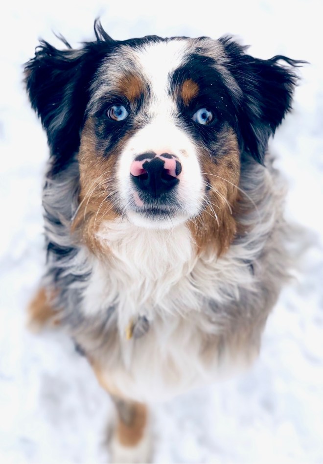
After recuperating in Oregon for a while we spent a month in the Southwest. My parents were in New Zealand so we took care of Leif, their mini Aussie puppy. We went to Phoenix first; Sara volunteered at Ironman AZ so she can sign up for next year! We also did some biking.
Mountain biking near cacti requires a bit more care. This was a trail near Kingman, AZ.
We also spent a few days with a friend in Vegas.
Leif tours The Las Vegas Strip.
Then we headed to Sedona for Thanksgiving.
Camping outside Sedona. Improving skills. Shoulder was reasonably healed!Great fun in the slickrock and gullies around Sedona. Leif loves to run! He’s a great mountain bike companion. Full moonrise over the cliffs of Sedona.
From Sedona we headed to visit Sara’s cousin in Durango.
Quick stop at the Four Corners. Biking in Durango where it was more winter than fall. Mountain biking at Alien Run outside Aztec, NM. Seriously, read this placque!
After our cousin visit we decided to seek out winter, first at Wolf Creek Pass and then Monarch Pass ski areas in Colorado. Leif absolutely loved the snow!
After a mere two days in the snow we decided we wanted a few more days in the desert so we headed to Moab. Unfortunately, winter had already arrived in Moab, too, so we just hiked and explored instead of biking.
Sara practicing her yoga at Deadhorse Point State Park. The snow really made the landscape striking. Camping on BLM land just outside The Needles section of Canyonlands. Sunset at Bighorn Overlook – Deadhorse Point State Park.
After Moab we headed north to the San Rafael Swell to see the Little Grand Canyon.
Then we hit opening day at Sundance. Bob was nowhere to be seen, except for all the brochures!
Finally, we headed back to drop Leif off in Oregon.
We stopped at the Bonneville International Speedway to see how fast we could drive house, but it is flooded in the winter. Van glamour shot.
Continuing the scenic route on the way back, we stopped at the Bruneau Sand Dunes south of Mountain Home, ID.
It was windy! I suppose that makes sense for the creation of huge dunes. Those ears!
Okay, so that’s the update. We spent a few days snowboarding at Crystal Mountain, WA before Christmas. Then after New Year’s we spent a few days with friends at Schweitzer ski resort outside Sandpoint, ID where I played with my new toy – a Rylo 360° camera. Expect a bunch of clips in future posts!
So now we have left Oregon and hit the road for good. A big storm is hitting the Sierras next week so that’s where we are. More to come soon, I promise!
Waze says the fastest way to Maine from Kansas is across central Michigan and into Canada, so that’s how we went – just south of Chicago, along the eastern shore of Lake Michigan, through Lansing and Flint, and into London, Canada. It’s usually easy driving across Canada and we figured the further north we went the cooler it would be anyway.
As Sara was driving somewhere across Ontario I started looking for mountain biking trails around Toronto. I found the lucky Canucks have a great trail system in the Don Valley right next to downtown with a number of trailheads. I figured we could not only have a nice ride, but that the friendly Canadians wouldn’t even bother us if we camped at the trailhead in the middle of town.
The Don Valley is a long park right through the heart of Toronto.
CN Tower is a dead giveaway for the Toronto skyline.
I was right. We made it in time for a short ride, then drove to a Loblaw’s grocery store parking lot that doubles as a trailhead.
The mountain bike team having an impromptu party at the trailhead at 10:30 p.m. assured us we would spend the night unmolested by Loblaw security so we parked in a dark corner and turned in to the jamming sounds of Canadian EDM (electronic dance music).
The next morning we went out for a longer ride to explore more of the Don Valley trails. The trails are very heavily traveled but in surprisingly good shape. They mostly follow the contour of the small canyon, but there are still plenty of technical ups and downs. According to the bike team, some local bikers are responsible for the various skills features spread around the trail system. There were some good bridges, logs, jumps, and even a see-saw. We did not ride the see-saw!
I only get off my own bike to take pictures in the tame sections. Here’s Sara digging through the woods of the Don Valley.
I did make one wrong turn and ended up taking us across a ridiculously narrow trail on a very steep side hill. I traversed the worst of it with one foot on the downhill pedal and one foot on the hillside above me. Sara walked. It was a learning experience!
Considering that we had another nine or so hours in the van and our home in the parking lot was so comfortable, I cleaned up before we continued.
Never have I ever…bathed in a Loblaw’s parking lot. [Michael raises hand.]The rest of the drive was uneventful. The border crossing between Quebec and Canaan, VT was the first place any customs officer asked to open the van. Good thing we weren’t smuggling in any Canadians! We pulled in to Sara’s parents’s camp in Maine about 10:30 p.m.
That’s well over 6000 miles from Fairbanks, AK a couple months ago!
Maybe we should head down to Key West to really finish off the trip!
For the first time in 9 months we are now leaving the van for 10 days as we head to Iceland to visit an exchange student my family hosted in 1985.
Despite the nasty head/crosswinds in western Kansas, we made it fine to Wichita with our gimpy van suspension. It’s a good thing we were visiting friends and family because it was high 90’s and very humid. Sleeping in the van without independent air conditioning would have been miserable.
Our first visit was with Steve and Stacy, a law school buddy and his family.
First things first, I have to show Steve (and his curious daughter) the injury.
Redneck welcome – we took the Jeep out for a gravel-road tour of the countryside.
There were a lot of bugs in western Kansas so the Hund got a bath.
They live in a development that has absolutely no need for a commercial fireworks show. In his area they can only buy fireworks for three days around the 4th and they don’t let the opportunity go to waste. Every third house or so was massively stocked with fireworks and the evening of the 4th sounded like the start of World War III. As one would predict with too much gun powder and too much faith in the quality of the manufacturers, we had a couple minor incidents that could have ended poorly. Fortunately, the only casualty was one of Stacy’s copper mule mugs, which by the look of things gave it’s life in service as it jumped on top of a mortar that shot sideways under the startled spectators’s chairs.
All of this ought to blow up something!
This is a girl who needs her own dog! She is already set to start a dog walking business after a little practice with Kenai.
This is what happens when you don’t listen to your dad and you throw a smoke bomb that crosses the street and sprays colored smoke all over the neighbor’s driveway.
Finding little things to light before the real show.
I didn’t get any good pictures of real fireworks so this is it.
We also went to Ada’s horse-riding lessons and watched her practice jumping on Star.
When we left Wichita headed for Kansas City, we stopped at the Tall Grass Prairie National Preserve. The preserve is roughly 10,000 acres of the little remaining tall grass prairie in the U.S., which used to cover nearly all of the Midwest.
They have reintroduced bison to the preserve as grazing is one of the key elements of maintaining the habitat and bison look cooler than cows.
The real importance of this picture is showing the head start Sara is getting on me when it charges.
Saturday night we went with my uncle to the Red Sox, er, Royals game. The bottom-dwelling Royals kept it close for a few innings. It helped that David Price tied a major league record by beaning three consecutive batters and then walking in a run. The Sox finally broke it open late and left the Royals in the dust, including scoring 7 runs in the top of the 9th. For us it was a great game to watch!
Xander Bogaerts’s bases-clearing double to take the lead for good.
The next morning we headed back to Lawrence, KS to visit my cousins and aunt and uncle. I was hoping for a kite-boarding lesson, but the wind was too light. Instead, we swam in the lake, then my cousin and I went for a mountain bike ride while Sara went for a kayak paddle. Biking in 95 degree heat and high humidity was not quite as bad as I would have expected, but it was still pretty bad. The trails along Clinton Lake were quite good with a mix of mildly technical rock gardens, flowing trails, and some roots. Despite being nearly all along the lake contour there were some short steep sections I couldn’t cleanly ride.
Kenai wondering why Sara did not take him paddling.
Biking cousins. Blair has even more bikes than I do!
Sunday evening we had a nice family dinner with my aunt and uncle and the cousins. My uncle made a beautiful brisket in his smoker, which would have been delicious if we had waited a couple more hours for it to finish. We sat watching the temp creep up, but it didn’t quite make it by the time we all needed to eat. The replacement BBQ ribs were equally delicious!
On Monday morning we managed one more ride with my cousin on the Lawrence River trail right near downtown Lawrence. The loop we rode was about six miles of super well-maintained one-way single-track along the river. They have bikers ride one direction and walkers/runners go the other way and it seems to work out well for multiple use.
We managed one other visit with a friend Monday as a guy I met through the FBI moot court program (where prosecutors went to help train new computer examiners how to testify) lives in Kansas City on the Missouri side. He is very supportive of our adventure and wants us to start our own YouTube channel! We had a good time visiting and comparing the van to his travel trailer.
Monday afternoon we were back in the van and well on our way to Maine. We checked the weather reports and saw the overnight temps were supposed to get back down in the 70s so we toughed it out in the van. I don’t think we actually saw anything south of 79 and it was obviously still very humid. We parked along the banks of the I&M Canal near Morris, IL and ran all of our fans all night. It wasn’t great with two panting humans and two panting dogs, but we managed some sleep. It definitely confirmed that we need to stick to cooler climates for our #vanlife adventures!
After leaving Snow Basin we decided the next mountain bike area we needed to see was Green River, WY, but it was 95 deg. and the middle of the day. Hard pass. It looks awesome, though, so it’s on the list for another trip.
The next option was Curt Gowdy State Park between Laramie and Cheyenne. That was good timing and even allowed us to stop in Laramie for a movie. (It’s our first movie with MoviePass and we wanted to see at least one movie before they run out of money and go under.) We left Laramie and headed into the nearby Medicine Bow Nat. Forest to camp for the night near the park. As we turned sharply into a trailhead across a cattle guard there was a huge bang and jolt. It felt like I hit the edge of the cattle guard as I swung into the lot.
We parked and I got out to take a look. The side of the van was fine. I crawled under to take a look and initially didn’t see anything. I went to take a look at the trailer hitch to see if I somehow bottomed out the back of the van, but it was fine. From the back I looked under and noticed that the right rear shock mount was a little angled. Is it supposed to look like that? I check the left, perfectly straight. I look back at the right, okay, it is a lot angled. Uh oh.
That doesn’t look right.
I go back to look from the front and it is readily apparent that the shock mount on the rear axle is bent and cracked.
Oh yeah. That’s smashed, bent, and cracked. The cattle guard even left some paint for us.
Things got a little quiet then as I pondered how bad it all looked. Well, we aren’t going to solve the problem tonight so might as well go to bed.
The offending cattle guard. Thanks NFS!
Fortunately we had great internet coverage (a nice change from the majority of I-80 in Wyoming) and I could lay there and fire up the Google machine. I also posted on the Ford Transit forum asking for opinions about whether I was at least safe to drive back to the dealer in Laramie 9 miles back on I-80. Everything I saw, and the one early response to my post, supported the conclusion that I could drive it safely back to the dealership.
We made it to White’s University Ford right when they opened and it didn’t take long for them to get it up on a lift and take a look. Scott “Scooter” the mechanic took me back to talk about what he was seeing and talk about what the shock actually does. Although the mount was bent and cracked, there is still a lot of steel still holding the mount to the axle. The shock is also not weight-bearing and it just dampens the movement of the axle, which is actually supported by the leaf springs. The air bag suspension I installed also helps so the same function, so his conclusion was that we were safe to continue to somewhere more convenient for repairs. He even said we could drive at regular highway speeds. Two huge thumbs up to White’s University Ford and they didn’t even charge us!
Well that is a huge relief! (Sara is equally relieved that she was not driving when this happened.)
With the prompt inspection by Scooter and the crisis averted, we still had time to hit the trails before heading on to Kansas. Curt Gowdy State Park is a very well developed and maintained state park with a lot of trails and two large reservoirs. It was pretty busy on 7/3, but still not so much on the trails. We hit two connecting trails called Stone Temple circuit (intermediate) and Ignoramus (advanced) for a quick ride. The trails are beautiful, winding through a mix of high desert and sage brush, Pinyon Pine, and pink granite outcroppings.
Stone Temple Circuit was mostly crushed granite with some outcroppings of more serious rocks, almost all of which we could successfully navigate. There are a number of alternate routes and skills areas to practice and we tried out a few of those spots. Ignoramus was the same, but with more serious rock obstacles. We still rode about 90%, but it would take some practice to ride it all cleanly.
Sara heading up a rock obstacle.
Up.
On.
Over.
This was one of the little skills sections.
Sara riding up and over a fin.
Dropping through the rocks.
Staying on the trail is obviously not a skill I have mastered.
So what could have been a disaster turns into an inconvenience and eventual expense. We made it the additional 10 hours out to our friends in Kansas and the suspension looks exactly the same.
After about six weeks playing and working on the van in Oregon we are back on the road with our mountain bikes.
Our first stop was for a quick visit to McCall, ID, a couple hours north of Boise, as we head back to the east coast. It is an outdoor mecca with two nearby ski areas, amazing backcountry, great mountains, and access to some of the best whitewater in the country. I got to spend time here and make a bunch of friends when I was a whitewater raft guide during college.
In 2014 we bought a small lot in a very cool development with a golf course and a bunch of mountain bike trails hoping to someday build a house and settle down here. Unfortunately we haven’t quite pulled off the building a house and settling down thing yet. Good thing we now bring our house with us wherever we go!
Despite the short notice of our arrival, we timed it well as a buddy and his wife were heading out on Saturday for a wilderness bike ride to check on some trail conditions and the progress of a trail maintenance crew.
I stole this shot from Dave’s FB page as he wanted to compare his VW to our Transit.
Most of our riding recently has been in concentrated mountain bike areas, but this was a regular wilderness trail in the national forest. There were quite a few challenging technical areas and a lot of places where we lacked either the skill, the legs, or both to make the climb. The challenge was well worth it, though, to be back in the mountains.
Sara, Michael, Sid, Dave – not a normal one in the bunch.
Riding through the meadow at our destination. Definitely worth the views.
Another meadow on our ride. Photo again lifted from Dave’s FB page.
Dave’s picture of Sara using the smart way to cross the creek.
Dave wanted to make sure he got a picture of us with the trail sign.
This is what happens when you give your phone to Sid.
On the way out everything was rideable, though the technical sections were challenging. Sara did a great job until near the end, where she took a digger into the rocks and jammed her thumb. Some vitamin I and a beer at the trailhead helped and I don’t think the injury will significantly slow her down. The final tally was about 14.5 miles and 1600′ of climbing.
The best part about riding with local friends was that we got to use their shower after riding! No truck stop, laundromat, or hose for us … yet.
On Sunday Dave took off for some more trail inspection, but he left us Sid. After comparing van builds with another buddy in McCall, Sara, Sid, and I rode a couple of the fun downhill flow trails at Jug Mountain Ranch, where we have our lot. These are super well maintained trails with fun rocks, jumps, and berms.
One last shower and it was time to go. Hopefully we get to spend a much larger chunk of time back in McCall this fall visiting and doing a little work on our lot.
Our current goal is to make it a to a buddy’s house in Wichita, KS for the 4th of July, but we want to ride a few places along the way. We left McCall around 4:30 p.m. and looked for good places along our route. Snow Basin, UT seemed like a good spot to shoot for on Sunday night and we made it just after midnight.
Nice view from the parking lot when we woke up.
In the morning some guys in the parking lot were nice enough to give us some info about the trails and we picked the Sardine Loop, which is in the national forest right next to Snow Basin. It’s a steady climb up, but you are rewarded with great views and super fun descent.
The Ogden overlook just off the trail with views back over the mountains to Ogden and the northern edge of Great Salt Lake in the distance.
Share the trails!
Because you might have this in your face when you come around a corner!
As you continue around the loop you get views of Pineview Reservoir and Powder Mountain in the distance.
Sara at the end of the descent.
Now that it is summer, we don’t have to rely solely on friends, laundromats, or truckstops to clean up because I installed a pressurized water line to the back of the van. Bike wash, dog wash, people wash. Now if I can only figure out an easy way to heat up the water a bit. It was pretty chilly!
Good thing it was hot out!
Okay, so we are on the road back east and our mountain bike plans are going well. Next stop, riding in Wyoming!
(This is going to be a very photo intensive post!)
Much of southern Oregon, especially the southeast, is a high desert in the rain shadow of the Cascades. Over the years we’ve done plenty of exploring in that area as a family, but my dad had a new area he wanted to explore along the Owyhee River. (According to the guidebook the Owyhee River was named for Hawaii because fur traders in the early 1800s imported natives from the Sandwich Islands, what is now Hawaii, to trap beaver in the area. The Hawaiins were promptly killed by the actual natives, and in their honor the English named it the Owyhee River, as Owyhee was apparently an early spelling of Hawaii. So, we actually did go to Hawaii…in Oregon.)
Our destination was the Chalk Basin, an area about 25 miles off of Highway 95, the main road in southeastern Oregon. While 25 miles doesn’t normally sound too daunting, the road is either dried (if you are lucky) mud or sharp lava rocks that eat sidewalls. Our trip in would end up taking 4 hours to cover the 25 miles.
Depending on how you go, the first thing you pass are the Pillars of Rome. These huge bluffs were landmarks to early travelers and someone, who had probably never even been to Italy, thought they looked like Roman pillars.
Another section of the Pillars of Rome.
And another.
On the way in you pass through one ranch, but then you are on BLM land the rest of the time.
As you can tell, this is high priority area for the BLM.
The guidebook (by William Sullivan) says, in the event of rain “your car will sink to its hubs in mud and you will have to camp for a day or two until the ground hardens.” It was not raining as we drove in, but there had been some serious thunderstorms in the few days before we went, and although most of the road was passable, there were still some major mud holes. Well, that’s why my dad bought his Jeep. (Seriously, going to this particular place was a large part of the reason he bought the Jeep!)
One of the first big holes. I was smart enough to drive around this one. Notice how clean the Jeep is.
The first few mud holes I just plowed right through. Fortunately, they were not anything significant. I got my first lesson as I charged into a relatively short mud hole, but I went a little right of the most recent tracks. I gunned it as it started to bog down, but it was too late and stupid traction control just slowed me down until I was stuck. There is no button to just turn off the traction control so it was time for 4wd low and “mud mode” on the Jeep, which does turn off traction control. I was able to slightly rock back and forth and I could feel a decent size rock ahead of the front tire. Fortunately, I was able to back up about 10 feet and then blast forward out of the hole. When we told one of Dad’s friends about this he said that if you don’t have to get out of the Jeep and use a jack/winch/tow you aren’t really stuck, so I guess we weren’t stuck, just delayed.
It didn’t look like much, but it was deep and sticky!
This is also about the time I learned to roll up the window when going through a mud hole.
At this point I started to get more conservative as I hadn’t really thought we would get…delayed…in the earlier spot. Clearly this mud was a lot stickier and deeper than I thought. Then we came to a huge long mud hole. I had just started forward and had to back up as it was clear we weren’t coming close to driving through this one. A little ways back I saw a track going off the road around the area so we scoped it out to see if it was passable. Mud flat to muddy creek crossing to damp desert pasture – Dad was ready to turn around, but armed with his Jeep and my bravado we were going for it. We made it! No problem at all other than a bit of sliding around.
A bit down the road from all of this fun we saw an antelope standing on the side of the road. As we approached a coyote took off from somewhere near the antelope and I couldn’t figure out why it was standing there just looking at us.
As I looked through my telephoto lens after it walked away it was pretty clear why it wasn’t moving fast.
I would not have expected a coyote to catch an antelope, but it sure looks like that is what happened. Originally I thought she might have been giving birth, but it is actually the meat of her hamstring that is torn up.
As long as we are talking animals, we also saw a bunch of curlews. I had no idea curlews hung out in the desert.
As I was taking pictures of the antelope I noticed a vehicle stopped at the next big mud hole ahead of us. It figures – go all the way off the grid and there are still people out there. Of course, it ended up that they were very happy to no longer be alone because they were well and truly stuck. The guy was just driving along the edge of the hole and somehow his wheels slipped sideways and he drove into a very deep mud hole. We arrived at 5:00 p.m. and he had already been digging/jacking for four hours. He had raised his front wheel nearly a foot but he was still solidly stuck. Fortunately with his previous effort and the Jeep it was easy to pull him right out.
Don’t get too close to the edge! You can see all the rocks he’s already put under his wheels but he was still stuck tight.
After this I was even more cautious. One time we again drove off into the grassland/pasture/lava fields well over 100 yards from the road to bypass a bunch of mud holes. As we finally made the end of the road overlooking the Chalk Basin, there was lighting and thunder all around. Amazingly we did not get rained on too hard, but there were major showers and lightning west, north and east.
You can’t have rainbows without rain!
Looking north into the Chalk Basin.
You can’t imagine how excited Dad was too get his Jeep at the end of a rainbow.
And then the clouds lit up!
First orange.
Then red.
So all of this and I haven’t even started talking about the hiking yet!
As described in the guidebook, at one time the Snake River used to flow across southern Oregon to the Pacific, but as mountains grew up the river was dammed, creating a massive lake in southern Idaho and southern Oregon between Boise and what is now the Steens Mountains in Oregon. It finally spilled out to the north, carving Hells Canyon on the Oregon/Idaho border. This massive lake led to all kinds of interesting deposits in eastern Oregon, including the silty layers that make up the Chalk Basin. Combined with the lava flows that followed the settling of the lake bed there are all kinds of great canyons and sculpted features to explore.
The old man is 75, but he still keeps a very solid hiking pace!
This is essentially the start of the canyon as the stream was just flowing along nicely before dropping between these lava walls.
Most of the hike in the narrow canyon is like walking on a smooth sidewalk as the debris that floods into the stream bed makes a perfectly level gravel path.
Occasionally there were steeper, rocky spots as well.
The cool twists and turns made for some good panoramas.
With the recent rain in the area the creek was surprisingly damp, with flowing water in places. Eventually we ran into a “dry” waterfall, which the guidebook says is where to turn back and climb up out of the canyon. Turn back? I don’t think so.
We just scrambled around the slick, sloping face on the side of the canyon. Someone was rather strangely hiking in his tennis shoes “because they are so light” and had more than a little trouble with the loose footing, but I got him around.
Looking back at the waterfall and the slope we traversed in the upper right around both falls.
The guidebook should have said “if you don’t take my advice to turn back you are just going to come to an even larger waterfall that you cannot climb around,” but it didn’t.
No getting around this one, though there was an old stake stuck in the canyon wall where people have obviously used ropes to scale up or down.
So we had to climb out of the canyon anyway.
Looking back at the impassable waterfall and the stream bed below.
The view of the Owyhee River from up on the bluff above the creek we came down.
As we walked south along the bluff above the Owyhee River we started to see the amazing sculpted hoodoos and goblins that are the best part of the hike.
The source of my photographer genes.
We hiked down to the river where we ran into the couple we pulled out of the mud hole the day before. They described their hike a little further south along the river so after a lunch we went for some more exploring.
Someday this is probably how it ends, which all in all wouldn’t be so bad.
Looking up at the formations we can hike into.
Yes they do.
The formations are each unique in appearance and structure.
The muddy rock in this hoodoo looks like a drip castle at the beach.
Right next to the drip castle was this big lump formation.
This narrow cleft extends about 50 feet up the hill to a 40 foot high skylight.
Dad disappearing into the tight, short slot canyon.
We spent what was likely a couple hours just exploring this one little canyon in the formation. While I never like comparisons to Utah geology as I think Utah is so amazing, it was very cool to be able to wander directly into these formations and carefully climb around. Surprisingly, I was able to climb all the way out of this area up some tight slopes – something I never would have expected as most paths cliff out quickly.
This is the view south from the little area we could explore – the amazing formations continue!
After exploring we hiked back up to our camp along a different creek bed. We probably only hiked about 8 miles round trip, but we were still pretty beat.
We had a beautiful tent spot overlooking the Chalk Basin.
The next morning we wanted to explore one more area the guidebook described as having a great overlook of more formations. This time our goal was to simply stay up high on the ridge and look down from the top. We drove just about a mile south and then hiked straight over to the river.
This amazing canyon is the one just south of the one we hiked down the day before.
More formations at every turn.
As far out on the edge as I could go.
From the top of that yellow dome in the last pictures, you can look back north at another huge formation. Across the ridge at the top of the picture you can just see the red tip of those pillars we explored the day before swelling above the canyon wall.
As you can imagine, I could post a ton of other pictures, but I’m sure you get the idea. The formations along this area are amazing and very easy to explore…as long as you can get there. Sullivan describes this area as “the national park that is not yet crowded with tourists — the wilderness that is not yet designated” and he is not exaggerating. Right now the only thing keeping the area from being overrun is its remoteness. Maybe it is a good thing not many people are reading this blog!
After crossing back into the U.S. we stopped in Olympia to visit a buddy I grew up with in La Grande. It’s crazy to think it has been nearly 10 years since we’ve gotten together.
Old friends, but not yet old friends.
Brad and his wife, Emily, provided some inspiration for our #vanlife as they are the proud owners of Oscar, a 1979 VW camper van. They spent many months traveling and living in the van and they still regularly take trips with their two kids. Naturally, we had to spend some time comparing the size of our vans!
Not really a competition, though he can pop up the roof for an extra bed and he has more than two seats.
Brad offered us the guest room, but with two rambunctious girls sharing the upstairs we were perfectly content sleeping in our own house in the driveway. Brad and Emily took us to a great state park at low tide where we could wander through an oyster bed and along the seaweed covered shore looking for crabs and other aquatic life.
I had never seen an actual oyster bed – really just a bunch of oysters laying in the mud.
With a shellfish permit you can collect 18 oysters a day, but you are required to leave the shells on the beach to give the new oyster larva a place to attach and start growing. Even the oysters you do collect/eat are likely to already having new tiny oysters growing on the shell so leaving the shells keeps the oyster bed growing.
Yum. Fresh oyster on the half shell!
Young Dungeness crab. Unfortunately they had just closed the crab season, and this one was too small anyway.
The next morning we went down on the beach directly below his house and did some more beach walking. Down on his beach we hunted Geoducks (gü-ē-ˌdək – if, like me, you can’t read that gibberish, it is pronounced gooey duck). Geoducks have a very long neck they extend up to the surface. When you try to grab them they can withdraw the neck very fast and stay super deep out of reach. Fortunately I found some really rocky beach where they couldn’t get away from me and I caught one.
Normally they are collected by divers on the sea floor, but I was not to be denied a prize. Of course, shellfish in this particular area are not entirely safe so this guy went back in the sand.
When you disturb a geoduck as you walk on the beach they shoot a stream of water as they start to pull back into the sand.
As we did not get to eat enough of our catch, we had to go to Chelsea Farms, the tastiest restaurant in Olympia, to sample the goods. For those of you around Manchester, NH this place is the Olympia version of The Republic with fancy super fresh, local fare. They have their own oyster farm out in Puget Sound as well. (I think Brad planned this carefully because he took us out for dinner the night before so lunch was on us.) If I had been an attorney in Olympia this is where I would have taken all the summer associates for lunch!
Chelsea Farms Gems, Bonitas, and Olympias, plus some Oregon Kumomotos. The Gems were the best.
Geoduck crudo that was amazing.
Our original plan after visiting Brad was to head back to Oregon, but he suggested that as long as we were around we should head out the Olympic Peninsula and visit Olympic National Park. I have always wanted to see the area and as we had no pressing obligations, this was a great suggestion.
We started on the southwest corner on the beach. Olympic NP has the huge section in the center of the peninsula, but also long strips of the coastline. Even on a cool Wednesday night in May the best spots at the campground were taken, but we still did pretty well with this view 50 feet from the bluff. This area is one of the only parts of the national park where we could take the dogs.
Nice to sleep with the ocean sounds.
Lots of beach at low tide.
We walked up to a rocky point on the beach that was exposed by the extra low tide of the new moon.
Exploring the rocks.
I always love the variety of life in the PNW tide pools.
The next morning we headed north along the edge of the park. There are some interesting stops to view giant cedar trees (easily 40′ in circumference) and walk in the Hoh rain forest, which gets 12′-14′ of rain a year!
After that walk we drove through Forks (no vampires in sight) and out to La Push (no werewolves in sight). Both communities still capitalize on the Twilight books as there were numerous references to vampires or werewolves. Between the towns there is also a sign marking the treaty line.
After La Push we drove north to the very end of the peninsula on the Makah reservation. We had heard from multiple sources the Makah were not as friendly as the other local tribes, but everyone we talked with was great. The next morning we again went for our beach walk and tide pooling. As we walked we noticed a bunch of creatures obviously buried in the sand.
I just assumed it was the same sand crabs I’d found on the beach the day before, but we met a woman collecting them and she explain they were not crabs, they were beautiful Olive snails.
She told us they collect the shells to adorn their regalia for festivals and dances. She was adding to her daughter’s dress and needed to collect plenty of shells. She said they were terribly difficult and smelly to clean, though, as they essentially just had to rot for a year to get the innards cleaned out.
Olive snails are carnivorous and among the fastest burrowing snails in the world. In some places they were all gathered together like the photo above, but as we walked we found a lot of places where the snails were clearly moving around hunting for little clams or something.
The advantage to being on the Makah reservation versus the National Park is that the dogs were free to run and play!
Kenai chases stick. Tanzi chases Kenai.
Good thing we bought those rubber boots in Alaska!
Role reversal. Normally it is Kenai who won’t stay out of the water.
Just as in Alaska, Kenai was happy to eat barnacles and mussels. He didn’t even mind a little hitch-hiker tagging along.
After our morning beach time we headed to the true tip of the peninsula at Cape Flattery. There is a nice walk out to the ocean cliffs with amazing views down into the caverns and rocks.
No sea otters.
But lots of nesting pelagic cormorants and pigeon guillemots.
Tatoosh Island, from which the Makah used to hunt whales.
We spent the afternoon touring through the Makah museum. The Makah lost a lot of their original practices in the 1800s and 1900s due to forced assimilation, but in the 1960s archeologists excavated some 500-year-old Makah houses that had been buried in a mudslide. This discovery and excavation seems to have rekindled interest in their history and they used the opportunity to create an amazing museum and preserve much of their heritage. One of the displays even noted that the find was important in a court case as the Makah were able to prove they had used nets for fishing “pre-contact.” As a result they were allowed to continue fishing with nets under their treaty rights.
By late afternoon we were again headed on. We wanted to see a bit more of the interior Olympic NP so we drove up to Hurricane Ridge, which is really the only road into the mountains of the park. Unfortunately, though not unexpectedly, it was quite foggy and wet at the top so I didn’t take any pictures!
We did see this cool Sooty grouse strutting on the side of the road.
I guess it was working because his girlfriend wasn’t far away.
That night we just drove up into the adjoining national forest and camped along the road.
The next day, which I remember was a Saturday, we stopped to visit Craig, another college friend, and his family in Port Townsend, WA. We arrived just in time for Rhody Fest (the rhododendron festival) and a classic small-town America parade and carnival.
The parade also include a series of electric cars, fancy cars, loud trucks, at least 6 marching bands, every local politician running for office, the democrats, the GOP, lawn mowers doing wheelies, floats from the other county parades advertising their own festivals, local businesses, a country dance team, a high school dance team, and, of course, the boy scouts. ‘Merica!
We didn’t really plan to stay long, but after wiling away the day watching the parade (it was a solid two hours), touring the carnival, eating hot dogs, and drinking at a bar overlooking the bay, we decided to stay the night in their driveway. Good thing we don’t have any deadlines!
The calm before the storm.
The storm.
The next morning before we could leave I had to go through Craig’s son’s escape room. It was very complicated (most of it logically, some of it only logical to a 9-year-old mind) and my time of 55 minutes (with hints) wasn’t going to set any records.
With our tour of the Olympic Peninsula complete it was time to head back to my parent’s in Oregon. Our general plan is to reset for mountain biking season, do some more work on the van, and then in a few weeks head east to visit friends and family along the east coast.
We got off the ferry in Prince Rupert, BC because the ongoing trip to Bellingham, WA increases the price threefold so it is worth driving the 900+ miles back south from Prince Rupert. It is also a very beautiful drive.
In the east we would have called this season mud season as everything starts to melt out, but here it should be called waterfall season. As you drive along the very full Skeena River, waterfalls are pouring off the mountains all around. I was not a particular safe driver as I was constantly trying to look around, slow down, or pull over to get a better look at the best ones. None of these great waterfalls even had a pullout to view them so either the Canadians don’t much care for falling water, these aren’t really the good ones, or they are only around for a few weeks as the snow melts. Regardless, it was an amazing drive.
As we approached Terrace, BC we saw the turn to Shames Mountain ski area. I had seen some info on the mountain and wanted to see more so we drove up the road to check it out. The drive itself was worth it as the road cuts back into a huge canyon with towering rock walls on both sides. We decided to just spend the night in the parking lot because it was getting late and it was a beautiful spot to camp.
The mountain itself is super small, only a double lift and a rope tow, but the wealth of Shames Mountain lies in the easily accessible backcountry. They get a lot of snow and have amazing terrain. (Of course they also have avalanche danger as this story from Avalanche Canada shows. Anyone serious about backcountry skiing should check it out.) There is also a fantastic backcountry map done for the area. Below is a small section, but if you are interested you should buy the whole thing. The guy has also made backcountry maps for the Whistler area and a few others in Canada.
I’m sure when these are first made the locals cry about their area getting developed, but they are such a fantastic asset for the rest of us visiting the area.
I had originally hoped to be at Shames early enough in the season to get out and take a few runs but I wasn’t feeling as adventurous now. Fortunately, Sara was.
Nice to tour when it is nearly 60 deg. and sunny outside!
Looking back to the base of Shames Mountain.
Again looking south toward the base of the mountain and the Skeena River Valley in the distance.
This is the wall to the west of Shames Mountain.
The end of the valley north of Shames Mountain. (Someone forgot to put on more sunscreen when she took off her shirt and paid a steep price!)
When we started hiking up the mountain we were just going to look around and then ride back down, but once we saw everything up there we had to take at least one run. This is looking into the bowl slightly up the ridge above the top of the t-bar. This is just the tip of the iceberg for what is easily accessible around the mountain.
I put on a light sweatshirt for the descent, but I’m not sure why. It was wonderfully warm.
Our lines in the north-facing slush. As warm as it was, I felt pretty good about this slope as it was still pretty firm under the slush. If you look closely you can see Tanzi slowly making her way down the mountain (she is in the middle of the left track). She was fine going up, but had a hard time coming down.
Kenai looking back up and admiring his line. He was probably wondering what took Tanzi so long to get down.
Here is some proof that it is possible to ski on a splitboard even while the skins are still attached!
It was a great way to [likely] wrap up the snowboarding part of our trip. It is also definitely a place we need to come next winter to explore more.
We continued along the Skeena River as the road loops north and then back south. Then the road follows the Bulkley River for quite a ways. Our guidebook again came in handy as it mentioned the Moricetown Canyon where the Bulkley gets funneled into a very tight channel. The Wet’suwet’en tribe gathered here for generations to fish for salmon jumping up through the falls and they still fish with dip nets or gaff hooks every year. Seeing the canyon while the river was flooding was quite impressive.
All of the rivers in the area here are world-class salmon and steelhead fishing and there are a lot of fishing lodges and fishing-related business along the way.
When the road turns south for good in Prince George, BC, you start following the famous Fraser River. The road also cuts over and follows the Thompson River for a stretch through the Thompson River Canyon. Regrettably, I did not take any pictures of the Thompson River Canyon, but it is absolutely amazing. It is a deep, rocky canyon with railroads on both sides and the road high above. I am not going to pirate this guy’s pictures, but take a quick look at this blog for some good pictures of his recent trip through the canyon.
On the drive I found a website describing the very few bridges across the Fraser River Canyon. One of those was a suspension bridge just north of Lytton, which sits at the confluence of the Thompson and Fraser Rivers.
Hiking through the flowers to find the bridge.
Yep, that must be it.
I have no idea why this bridge is even here, but it is exceptionally solid.
Sara did not want to join me.
Just in time for sunset looking upriver.
We found a great little forest road to pull off on for the night. Turning around was a bit of an adventure, but I didn’t get stuck or roll the van so let’s leave it at that.
Van go in the woods.
Van Gogh in the woods.
Our final morning in Canada we headed down the rest of the Fraser River Canyon to Hope, BC. After crossing back into the U.S. we were scheduled for a TSA Pre-Check interview so we though it would be a good idea to grab a shower. Hope continued the Canada benefit of having a nice local aquatic center where we could shower and take a quick swim. (For those of you wondering, despite living in a van and showering only occasionally at local swimming pools, we were approved as “trusted travelers.”)
In our final installment of “small world,” the customs guy at the border in Abbotsford, BC grew up in La Grande and was in my Dad’s scout troop for a couple of years.
Last Saturday decisions were made. We knew the Alaska portion of #vanlife had to end at some point and we didn’t have any more specific Alaska goals that we could accomplish in the next week or two. Fishing season is still a little ways off and spring generally comes late to Alaska so much of the other sight-seeing won’t be great for a few more weeks. Considering some of our longer-term summer goals, it was time to head south. Sunday morning we drove out the rest of the Denali Highway, finished up the last blog post, and made ferry reservations out of Haines for Monday evening.
We stopped on Sunday for just a few hours in Fairbanks to visit Denise, Sara’s friend from Maine. She took us out to a brewery where I got to chat with her friend extensively about his various hunting/fishing trips and other local AK knowledge. In another installment of “It’s a Small World,” we also ran into some people we knew from Tailgate at the brewery.
After that quick stop, we left Fairbanks at 9:00 p.m. planning to take advantage of the late light. We had a solid 12 hours of driving and I didn’t want to be too rushed Monday so I drove until about 2:00 a.m. Fortunately we only saw a few moose along the side of the road and the only one in the road was while it was still light. We did see a lot of snowshoe hares, but unfortunately none were being chased by a lynx. We crossed the border and camped in the same field we slept in on April 4.
April 4. It was 0 deg. that night.
May 6. I didn’t dare drive in to the field at all.
While I slept Monday morning Sara kept us moving south. Although there was a lot more ground showing, the lakes were still frozen and it still felt like very early spring. We made the turn to Haines and as we climbed up to 3000’ over Chilkat Pass and Three Guardsmen Pass it was again late winter with plenty of snow and blowing cold.
Approaching Three Guardsmen, the peak on the right.
The descent into Haines and the steadily climbing thermometer was rather mind-bending. As we hit the river bottom along the Chilkat River the leaves on the aspen and birch were coming out. Grass was growing and cottonwoods were leafing out. Before we got to Haines we hit 64 deg. so we took the dogs out for a walk on the still-mostly-exposed riverbed. It felt nice to bask in the sun, but very weird. On Sunday we were in late winter at Denali and on Monday we were in full spring in Haines.
The fresh green really felt strange.
Rivers and mountains (and dogs).
The peaks around Haines are amazing. Apparently there is now a ton of heli-skiing out of Haines, including the finals of the Freeride World Tour.
Haines seemed like a very cool little town, sort of like Homer. It felt like real people lived there and at one of the shops we ended up in a long conversation with a mostly-retired river guide about the Tatshenshini River. I know one guy who rafted it a long time ago when it was extra wild and remote, but it is still an exceptional wilderness river and now at the top of my bucket list. A woman explained that Haines has refused to become a full cruise stop so they don’t get the extreme influx of tourists that Skagway, Juneau, and Ketchikan get.
We left Haines on the ferry in the sunset light at 8:45 p.m. The ferry was pretty empty except for a large contingent of sled dogs that were headed to Juneau, where they would get flown up on the glacier to be excursion dogs for cruise ship tourists. We had gone far enough south that the daylight disappeared much sooner. As we started down the Lynn Canal toward Juneau we watched the scenery and wildlife from the outdoor solarium on the back of the ship.
Leaving the ferry dock.
Sunset right over Haines.
One of the many waterfalls coming down into Lynn Canal.
We must have had “good listeners” tattooed on our forehead because we were quickly accosted by 74-year-old Harvey. Harvey was returning to his camp in Gustavus from his winter in Dawson. He had just come back from an 800-mile round-trip solo sled dog trip. We learned all about his life, with serious Oregon and Maine connections, and how he ended up in Alaska. In between his stories we managed to tell him a couple things about us, but not much! After a few hours I finally took my leave and Sara escaped with me.
Sara was very nice for the dogs and got up in the middle of the night when we hit Juneau. The dogs have to stay in the vehicles and we can only go visit during layovers or on very occasional visits to the car deck so they were not terribly happy. When we got up in the morning we were past Juneau and well toward Sitka. Part of the reason we chose this ferry schedule was becase it went out to Sitka through some very narrow channels and islands. The scenery is amazing as the ferry slides through channels only a couple times wider than the boat. We saw a distant whale, lots of porpoises, seals, and one brown bear on the shore of an island. We were lucky for this time of year and had nearly unbroken sunshine on this leg of the ferry.
Between the buoy and the shore was not much wider than the ferry.
Channel dotted with good seal rocks.
This must be a fun place for a ferry captain. It would definitely keep you awake.
In Sitka we walked the dogs then took a taxi into town for a very quick visit. We walked a quick loop of the downtown to see a few historical sites before heading back to the boat. Sitka was originally a Russian settlement and there are a lot of historical markers and buildings. We did an exceptionally quick tour of the Russian Bishop’s house, built in 1842. They have managed to restore much of the house to how it looked in the mid-19th century, including exposing some of the original construction so you can see how it was built and finished. On our exploration of Castle Hill we learned that Sara was born on Alaska Day, October 18. Shouldn’t that make her an honorary Alaska resident or something?
The view from Castle Hill.
The Russian Bishop’s chapel in his house.
The ferry just backtracks the narrow passages through the islands but it was fun to see again at a different tide. We went to sleep before we really saw anything new as the ferry headed to Petersburg and then Wrangell. We entirely missed Petersburg and woke up part way through the Wrangell narrows on the way to Wrangell. We didn’t see the narrowest part, but the apparently the Wrangell narrows are even narrower than the Sitka narrows. The topography near Wrangell is quite different, though, and when we woke up there were grassy banks below the trees and fishing cabins common along the narrow channel.
After Wrangell it was on to Ketchikan. Along the way we saw a ton of Dall’s porpoises and one orca. Sara’s high school friend, Fred, lives in Ketchikan so we decided to lay over about 40 hours and catch the next ferry on to Prince Rupert, BC. (This is the same friend who has the cabin we stayed at outside Kenai.) Fred and his wife Kaley have a great view of the water and we sat on the deck at sunset watching whales spout. Though we didn’t see any crazy jumping, it looked like they were fishing with bubble nets as there was a regular series of very close spoutings.
Old friends.
Nice view from Fred’s deck.
This is with a telephoto lens, but with the sun setting over the water you could clearly see the whales spouting with your naked eye as the sun lit up the spray.
It was fun for Sara and Fred to catch up and Fred was able to answer a lot of the questions we had come up with from our travels (e.g. why there are so many wrecked/burned cars just abandoned along the side of the road). Fred and his wife Kaley used to live in Dillingham out in western AK and, as a state trooper and then a game warden (just a division of the state troopers), Fred has seen much of the state. Unfortunately, Kaley was in Portland, OR for work so we didn’t get to meet her. Of course, this is just an excuse for me to come back as we need to meet Kaley. Kaley also has a rather serious fishing problem and it would be great to come visit when she is around to act as a fishing guide!
Though we didn’t have too long to explore Ketchikan, we hit the SE Alaska Discovery Center and a hiked a few short trails. I was rather put off by the massive cruise ships docked in Ketchikan (four at one time on Thursday), but the video about the history of Ketchikan explained how such tourists were always part of the Ketchikan scene as steamships used to come visit in the early days.
Wandering in the rainforest with blooming skunk cabbage.
Skunk cabbage.
Fred sent us out to starfish beach where we saw … starfish.
And this cool sea fan of some sort.
Kenai decided he liked the taste of barnacles and mussels so he grazed on the rocks.
The final leg of our SE Alaska ferry tour left Ketchikan very early Friday morning so we were up early to head out. Sara had been feeling lazy and the dogs were going to get stuck in the van for most of the day so while I parked in the ferry lane Sara took Kenai for a run. The trip from Ketchikan to Prince Rupert is only about 8 hours and the scenery isn’t as interesting so I promptly went back to sleep. It was also cool and rainy most of the way so there was not much interesting to see.
The most interesting thing we saw in Prince Rupert was this container ship getting simultaneously loaded and unloaded. We counted at least 21 rows that were at least 17 wide and 7 high, so the ship carries at least 2380 containers.
Taking the ferry through SE Alaska made me almost feel as if it should be a different state. It felt far more like the Pacific NW than the rest of Alaska, which feels alpine/arctic. There are still some rather amazing mountains, but the islands are dense temperate rainforest with massive spruce, hemlock, and cedar trees. On our hike in Ketchikan we even saw huge banana slugs, which I have only seen on the Oregon and Washington coasts. I suppose that variation is what happens when the state covers as much area as 1/5 of the rest of the U.S. states. It is even more shocking that in all our five weeks touring Alaska, including travelling almost every major road in Alaska, we saw one small corner of the state. I have travelled a lot of places and, while I always say I want to go back and explore more, Alaska is one place where I am adamant that we come back to spend more time. Even though it is remote and much of the state is wild, it is readily accessible and easy to visit from the lower 48.
Friday morning we headed into Denali Park. The road is 92 miles long, but it is currently only open to mile 30. As of May 15 you can’t even drive the road in your personal vehicle and have to take the park bus, so even though it was not open all the way it is a fun time to visit. Unfortunately, the weather did not really cooperate and we could never see Denali itself from the park road. Of course, the views are still amazing and there was almost no one else out there.
We stopped first to visit the Denali sled dogs. Prior to WWII sled dog were the primary means of patrolling the park. After WWII the park started relying more on snow machines and snow cats, but over the years those proved challenging as they were more prone to breaking down in the extreme cold or getting stuck. In the 1970’s the park again started using sled dogs and the dogs have been used ever since. In the summer they do some training and they get lots of walks, but they are primarily used for education and outreach. In the shoulder season now they are still doing some training pulling sleds on the road, but we didn’t get to see it.
Sara getting some love from Steward. He is 10 months old and one of the few dogs you can freely play with.
Beautiful eyes.
We came during their afternoon nap, but they all got excited when one of the dog walkers came to take a dog for a walk.
We took our time on the drive in, but we didn’t see much other than the wilderness.
On the one hand the views are all the same.
But on the other hand they are all different!
We could see Dall sheep on the rocks a little ways down Savage River, but we didn’t get out to hike. It’s easy to see why the road takes a long time to clear because in places there are huge drifts and with the light snow and wind while we were driving it was evident new drifts continue to form. When we got to the end of the road at mile 30 we planned to walk farther down the road with the dogs. The road is actually mostly clear all the way to mile 56 and if you have bikes you can ride all the way down. As we were about to head out, a couple came back down the road and told us there was a grizzly reported to be just down the road about a mile and asked if we could all walk together. We put the dogs back in the car and I grabbed my better camera and we started down the road.
A mile down the road it crosses the river and we started looking for bear tracks. They were actually pretty easy to find and they were huge! Across the river, the forest gets denser on both sides of the road so we tried to just stay close together and walk slowly. This tactic, of course, is the difficult choice between whether you want to alert a bear to your presence so it moves away or whether you want to stalk a bear so that you can get a good view. We figured that with all four of us staying together we had a good chance of appearing sufficiently dangerous if we did surprise the bear that he would run away instead of attack us. Naturally I have no idea if that calculation was reasonable, but let’s face it, the vast majority of bear encounters do not result in an attack so I think the odds were with us. We also each had a can of bear spray so in the worst case scenario, Sara and I could just spray the other couple and run away while the bear munched on them. (As I write this, Sara tells me they had bigger cans of bear spray so it also might have gone the other way.)
The tracks went along the edge of the road and it was apparent the bear was digging into the small bank for roots/bugs/animals along the side of the road.
Big bear tracks = big bear!
Casually tearing up the bank.
The wind was blowing strong in our face and it was snowing moderately so our approach was pretty quiet. As we started around the first corner, Sara decided to go to the other side of the road for a slightly better view around the bend. She quickly motioned to us the bear was right there so we regrouped on that side of the road to watch. He was just slowly walking away from us digging in the bank. He never once looked in our direction or made any indication that he knew we were there. To our untrained eye he seemed massive, easily as big as the ~850 lb. bear we saw at the wildlife center. The only downside to where we caught up with him was that he was standing right by the road sign so every one of my pictures has the sign in it. We were only about 50 yards away and there was no way we were going any closer to get a different angle. We watched him for about 15 minutes before he went just a little too far around the bend for us to see. Being the adventurous type we all are, we slowly moved forward around the corner until … he was gone.
No question he’s a grizzly with that face and the hump.
Yep, he’s a biiiig bear.
Big paw!
Check, check, check. Hahaha, none of those!
I remain convinced he didn’t not see us, but the wind started swirling a bit so he could have scented us. Now it was a bit eerie because this huge bear was somewhere just off the road in the woods. Did he just lie down next to the road up ahead? Did he walk away? Did he circle around to get down wind of us and he was now stalking us? We stayed together keeping an eye ahead and behind, but there was no sign of him. We certainly didn’t hear him go crashing through the woods away from us. We kept slowly moving forward until we could see his tracks into the woods, but we couldn’t see where he had gone and we weren’t about to follow him any further. I had already composed a number of headlines about our demise but I wasn’t really looking to make them come true.
We all headed back to the cars, now making plenty of noise and enjoying the thrill of having just seen a huge grizzly bear up close. After we were back in the parking lot another work vehicle came back down the road through the gate and told us there was “biiiiig bear” back down the road, so apparently he came back out of the woods after we left, or perhaps he had wandered further down the road through the trees. The woman said a number of times how big he was so our impressions of his immensity were confirmed.
It was late as we drove back to the park campground and we saw at least seven moose on the way back.
Grazing on the side of the road.
Just starting to grow new antlers.
Roadside snowshoe hare. The lynx population should be good this year because there were a ton of hares.
Two moose were standing next to the road as we came along at one point and as we drove slowly forward expecting them to run off to the side they started running down the road. We drove slowly behind them, the other couple next to us filming the scene as well, and they absolutely refused to turn. I am sure the park rangers would be upset at us for harassing wildlife, but no matter what we did they just kept running ahead of us down the road. Finally there was a car coming the other direction so they were trapped. We waited about another 10 minutes for them to move off the road but they still refused. I finally started edging forward in the other lane and they eventually went into the snow. As they started off it was readily apparent why they didn’t want to leave the plowed road because they were often breaking through the crust into snow up to their chest.
We spent Friday night in the campground with the other couple. Joseph was English but lives in France and Caroline was French but hasn’t lived there much. They have been working in Vancouver, BC and when they save enough money they go on a trip. Their last trip was across Russia, Siberia, and China by train. We pulled a picnic table up next to the van and cooked outside using the induction stove and an extension cord, but the snow higher in the park was rain in the campground so we didn’t want to set outside to eat. The four of us and the two dogs piled into the van for our first van dinner party. We put the dogs up on our bed, Joseph and Caroline sat on the swiveled seats, I sat on the electrical cabinet, and Sara sat on a cushion (aka the dog beds) in the aisle. It actually worked quite well and we had a nice time getting to know them.
Saturday morning was much sunnier so we went back into the park to see if Denali wanted to make an appearance, but it was still covered in clouds.
Denali hidden in the clouds, but you still can’t beat these views.
We decided to drive back toward Anchorage just a bit and drive out the Denali Highway, which is not to be confused with the Denali Park Road, which is not to be confused with the Parks Highway between Anchorage and Fairbanks. The Denali Highway is a 135 mile gravel road from Cantwell to Paxson. It traverses just south of the Alaska Range and is reported to be one of the most beautiful road in Alaska. The DOT web site hinted that the road was not fully open, but it did not say it was closed and the sign at the entrance to the road just said it was not maintained until May 15 and travel was not advised. As we learned, on April 15 Cantwell starts clearing its side of the road and Paxson starts clearing its side. They try to have the road open by May 15. As of May 5 this year, Cantwell has made it 73 miles and Paxson has made it 60 miles. 73 + 60 = 133, which means there are only two miles not plowed in the middle. Oh well, it was well worth the drive.
Rough road with amazing views.
Somewhere in those clouds are three 11,000’+ peaks.
This end of the Alaska Range has peaks up to 13,000 feet, but those were also lost in the clouds on our drive even though our trip was mostly in sunshine. The terrain is amazing and the road lives up to its billing as one of the most beautiful roads in Alaska. As there are so few roads really driving out into the wilderness here, this road is a great opportunity to see some exceptionally remote and difficult terrain. We still have not seen any wildlife more interesting than moose and ptarmigan, but there are also caribou, wolverines, wolves, bears, otters, and other weasels out here.
Willow Ptarmigan.
Look at those feather snowshoes!
Willow Ptarmigan obviously eat pussy willows.
It is amazing that even as light as they are, the ptarmigan still fall through the crust sometimes.
As we approached the end of the road we found the Alpine Creek Lodge, open year-round. During the winter they are open to snowmobilers, trappers, dog sledders, and other hearty souls; in the summer spring/summer/fall they are open to tourists, hunters, fishermen, and anyone else who manages to get off the beaten path in Alaska. The lodge looked remarkably comfortable so we had a drink and chocolate chip muffin (no pie available today) before starting our drive back toward Cantwell. While we were there a rented SUV arrived. The man explained the elderly women with him thought the lodge was only 10 miles off the road and they seemed rather distraught to have driven nearly four hours on a rough dirt road with no cell service to get to the lodge. I wonder how often that happens!
We were really sad we couldn’t have pie a la mode for my father.
The light was beautiful as we started back about 8:30 p.m. and the mountains, trees, and rivers were gorgeous. There were a lot of moose along the road, but still no wolverines or bears (some bear hunters at the lodge said a wolverine ran down the road in front of them that day).
Good thing for the panorama feature on the iPhone because the scenery is too vast to capture in a single frame! If you look carefully you can see two moose in this picture.
Clouds shooting out of the Talkeetna mountains to the south.
Crossing the Susitna River.
Love this shadow of The Hund crossing the Susitna River.
Bald eagles are everywhere in Alaska so I haven’t really bothered taking any pictures, but I finally found one I liked.
Sara decided she needed some exercise so at 9:30 p.m. in the late evening light she took Kenai, with his loud bear bell, out for their own Denali Highway 5K. The bells must have worked because she didn’t see the two moose on the road I saw as I drove ahead of her.
Sara and Kenai crossing the finish line of the Denali Highway 5K approx. 10:00 p.m.
As we have no immediate destination we decided to spend the night along the road hoping it might be clearer in the morning, but that hasn’t happened. I have been trying to type this blog on my lap as Sara drives the bouncy road back to Cantwell where we will figure out where to go next!